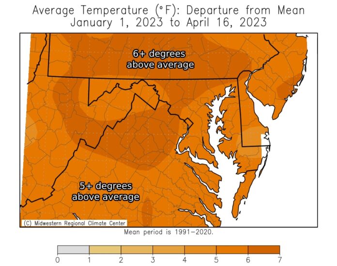
Washington’s weather has been all over the place lately, like a kid with ADHD hyped up on sugar. It’s been feeling more like Memphis than the nation’s capital, or even Sacramento. Yikes.
This year’s average of highs and lows every day has put D.C. at a toasty 49.4 degrees, beating out the previous year-to-date leader in 2012 by 0.4 degrees. It’s a full 6 degrees above average too. Someone’s cranking up the heat!
Things aren’t looking cooler in the lows department either. The average low temperature of 40.4 degrees is the highest to date, beating 2012 by 0.5 degrees. The average high temperature of 58.5 degrees is also a record breaker.
It’s like we’re living in some sort of sci-fi movie where the weather is trying to cozy up to us. Four of the top five warmest years on record have taken place since 2012. It’s like Mother Nature decided to turn up the heat and stay there.
In 2023, there have been three record highs and one record warm low so far. The latest record was a warm low of 65 degrees this past Saturday. I mean seriously, 65 degrees as the low? Might as well sleep in your oven.
Sure, Washington has yet to hit 90 degrees, unlike other places in New England that reached the mid-90s last week. But the number of days where the temperatures reached or exceeded 80 degrees has been impressive. Eight days so far and we’re only in mid-April. The record through mid-April was set in 1945 with 11 days at or above 80 degrees. It looks like we’re trying to break that one too.
Not even the morning frost is sticking around this year. There have been 15 of those so far since Jan. 1, the fewest in record history by over a week. 2012 is once again nowhere to be seen – that year had 23 such days.
Washington isn’t the only city basking in the warmth. Baltimore and Dulles are also having record-hitting years. The average temperature at Dulles is 46.9 degree, 1 degree hotter than the previous record in 2012. In Baltimore, the average at 47.6 degrees, which is 1.4 degrees warmer than the old leader in 2012.
It’s like a giant heat wave hug that’s spread across the East Coast. Cities like Miami, Pensacola, Raleigh, Philadelphia and New York are all experiencing their warmest year-to-date temperatures too. It’s like we’re all in this together, trying to see who can sweat the most.
So what’s causing all this heat? A weather pattern that’s decided to stay awhile. With a dip in the jet stream in the West, there’s a bump in toasty high pressure for the East – which is keeping us all warm and sending most storms to the Great Lakes. That’s also causing drought across the area. Great.
A cooler pattern should (hopefully) emerge in the next seven to ten days, but who really knows? Even if there’s a chance for coolness, the longevity and coolness compared to normal remain to be seen. After all, it’s not like cooler air will make us shiver like penguins.
The problem with cooling down is that it’s usually minor compared to the warmth we’ve been feeling. We often wait for days for some chill to settle in, only to be surrounded by warmth once the mini-cooldown is over. Not to mention, low temperatures aren’t as low as they used to be thanks to urbanization and climate change. It’s time to say goodbye to those chilly nights.
It’s hard to predict what’s going to happen next with the summer ahead of us. A major signal for significant heat doesn’t exist yet, but that hasn’t stopped the warmth from creeping in. With the developing El Niño phenomenon happening in the equatorial Pacific, it looks like things will be hot, hot, hot for the next year or two.
It’s safe to say that 2023 will probably be one of the warmest years on record…”historically” speaking. Of the top five warmest years, all finished in the top 10 warmest for the entire year, with three of the top four leading the charge. 2012, 2017, and 2020 are the top three warmest years in D.C. Looks like we’re trying to add another year to that list.
Serious News: washingtonpost

